Figure18

Back Home Next


Title Page
Preface
Background
Conceptual Framework
Theory
Application
Testing
Prescriptive Use
Conclusion
References
Table3
Figure Captions
Figure1
Figure2a
Figure2b
Figure3
Figure4
Figure5
Figure6
Figure7
Figure8a
Figure8b
Figure9
Figure10
Figure11
Figure12a
Figure12b
Figure13
Figure14
Figure15
Figure16
Figure17a
Figure17b
Figure18
Figure19
Figure20
Figure21

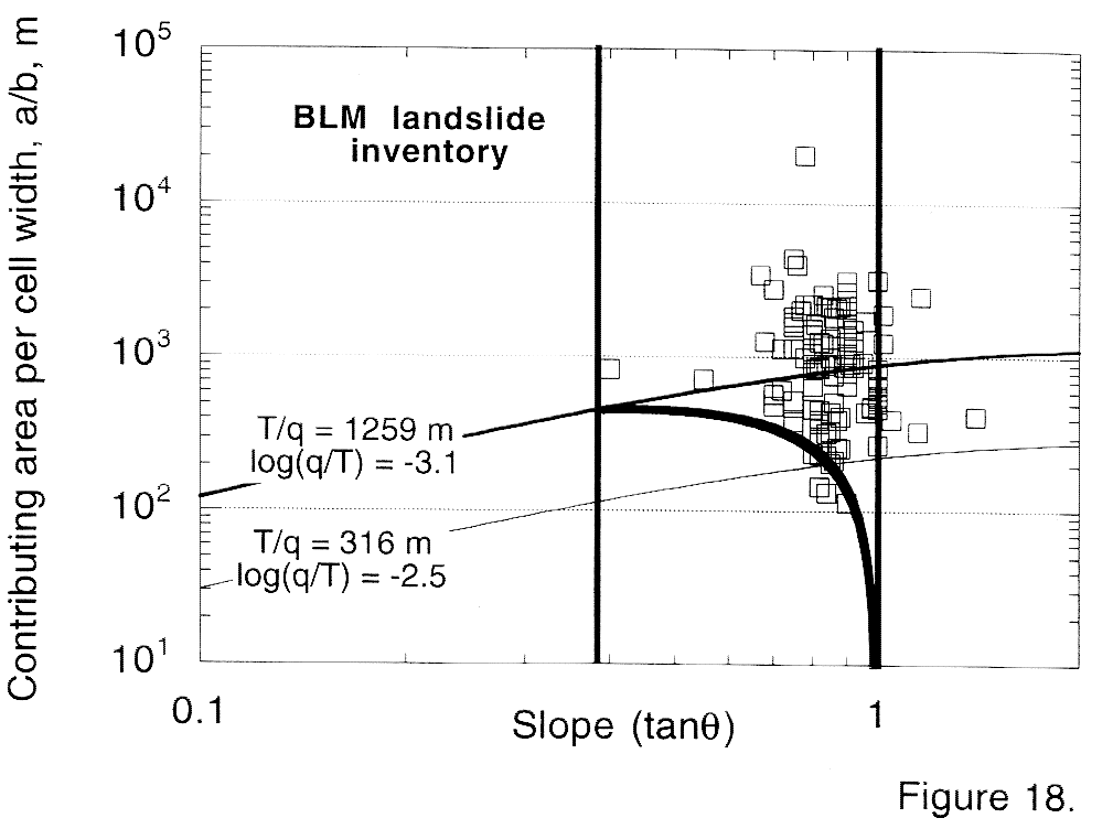
Figure 18. Comparison of stability fields and mapped landslide scars in the Oregon Coast Range. Landslide data were provided by Barry Williams of the Bureau of Land Management and were obtained by field mapping. Stability fields (as shown in Figures 13 and 14) are for a friction angle of 45 degrees and a bulk density ratio of 1.6. A value of log(q/T) = -3.1 effectively separates unstable from stable domains.

figure18.gif (31984 bytes)


Copyright 1998, William Dietrich and David Montgomery
For problems or questions regarding this web contact bill@geomorph.berkeley.edu.
Last updated: November 01, 1998.