Figure19

Back Home Next


Title Page
Preface
Background
Conceptual Framework
Theory
Application
Testing
Prescriptive Use
Conclusion
References
Table3
Figure Captions
Figure1
Figure2a
Figure2b
Figure3
Figure4
Figure5
Figure6
Figure7
Figure8a
Figure8b
Figure9
Figure10
Figure11
Figure12a
Figure12b
Figure13
Figure14
Figure15
Figure16
Figure17a
Figure17b
Figure18
Figure19
Figure20
Figure21

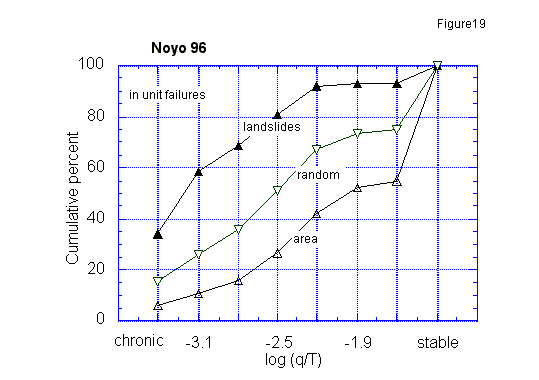
Figure 19. Cumulative percent of the watershed drainage, number of mapped landslides, and random landslides for given log(q/T) categories for the Noyo watershed, California.

 figure19.gif (8091 bytes)


Copyright 1998, William Dietrich and David Montgomery
For problems or questions regarding this web contact bill@geomorph.berkeley.edu.
Last updated: November 01, 1998.